Wood supply goes digital

Modern technology is taking wood supply into a new era

Digitalisation is revolutionising the forest industry and is taking the wood supply of mills into a new age. Modern technology has brought totally new ways of collecting data that provide even more accurate and higher-grade information of forests.

Effectively utilising this abundant and valuable data about forests is a veritable leap in development for the forest industry, because the more we know about our forests, the better and more sustainably we can utilise them.

Modern technology

Finland’s forests are doing better than ever before

Sustainable forest management has deep roots in Finland, and now all that hard and systematic management work is bearing fruit. Our forests are in good shape, and there is more wood growing in them than ever before.

This is a fantastic starting point for the digitalisation of the forest industry. “We can take great development leaps with the new technology and data management. They help us to utilise our wonderful forest reserves even more effectively,” says Jarmo Hämäläinen, Research Director, Metsäteho.

Innovative solutions unique in the world

These days, technologies are being used in northern forests in data collection and wood supply that cannot be found elsewhere. “Data on its own is not enough: it has to be processed into a form that serves its recipients – be they forest owners, wood buyers, forest machine operators or wood supply planners. In the forest industry, systems are continuously being developed to make maximal use of data so that better decisions can be made. The point clouds from laser scanning alone do not make us any wiser. It’s only when they have been processed into systems supporting decisions that they produce benefits,” says Hämäläinen.

Laser scanning
The more effectively we can make use of the data from our forests, the better we can plan the jobs that need done in the forest.
Digitalization

The digital leap in our forests is bringing considerable savings

Digitalisation and the improved use of forest asset data are bringing both considerable savings and efficiency improvement to the forest industry. When we know the wood raw material and we can identify the upgrade value of different felling sites as well as the terrain and road features of forests, we can plan the stages of wood supply more efficiently.

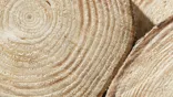
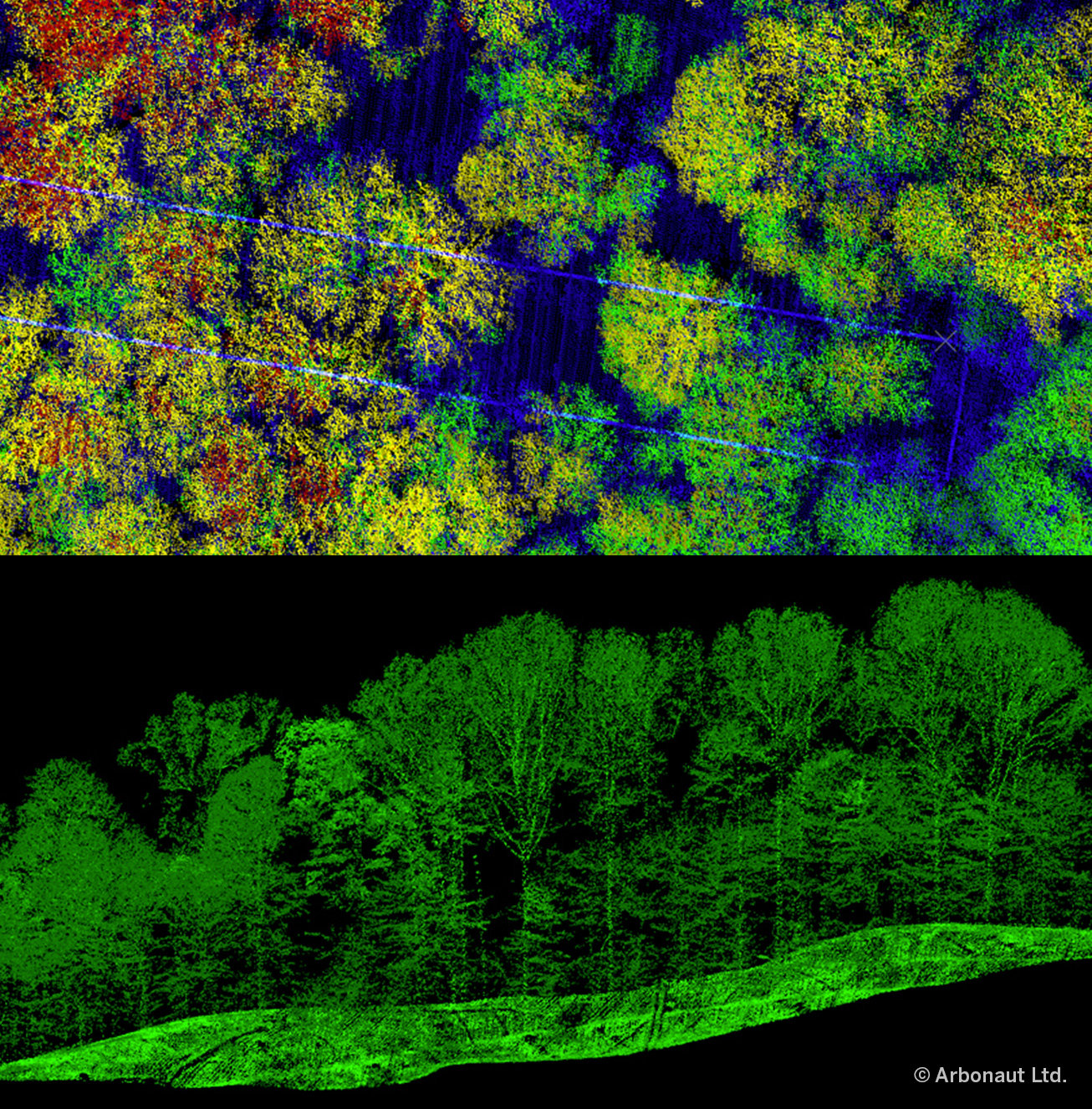
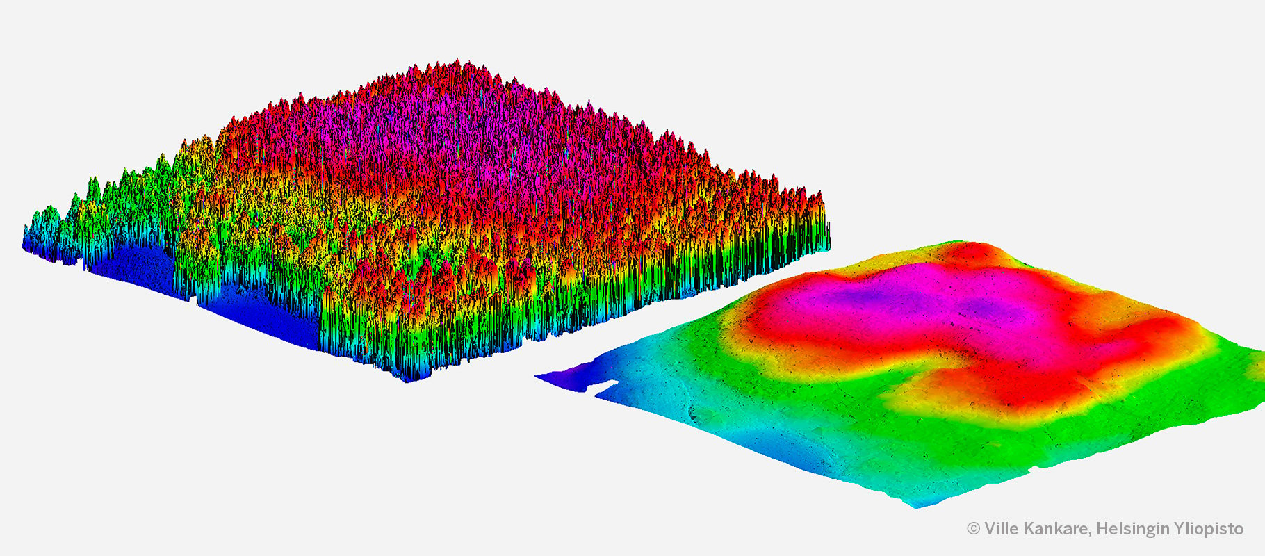
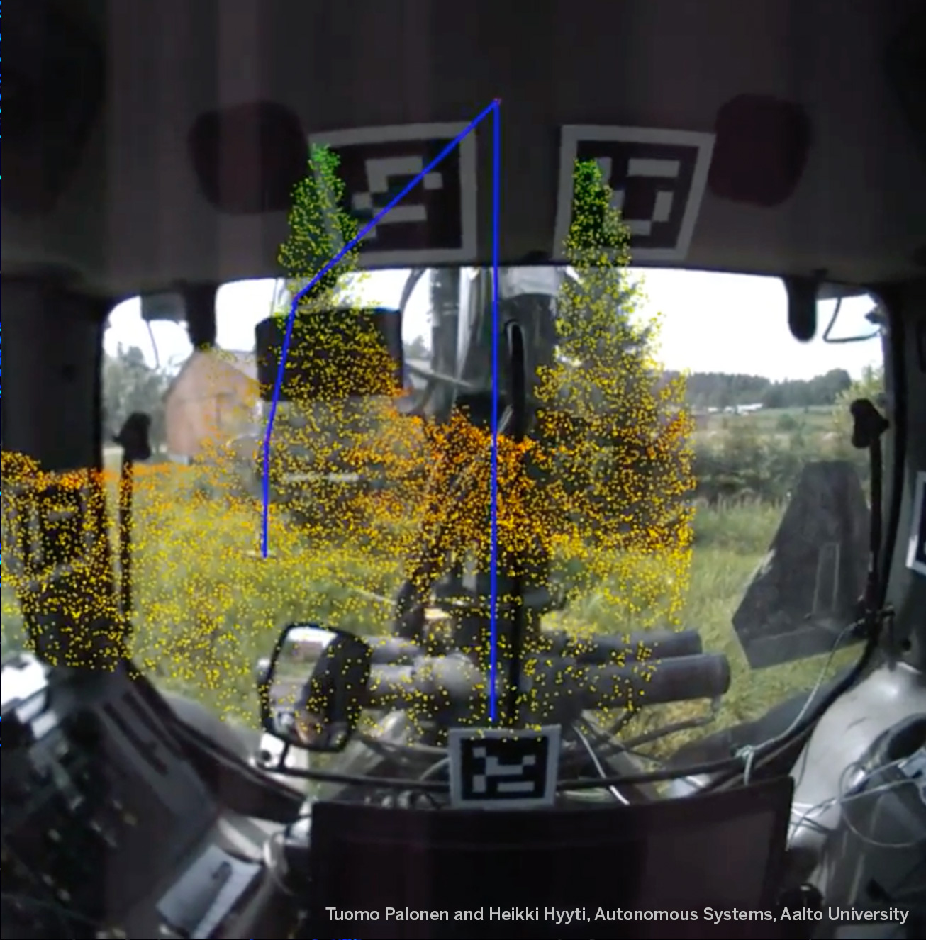
Precision-guided wood supply improves the productivity of the forest industry. When we know what kind of trees there are in each location using e.g. remote sensing, we can plan in advance which raw material it is worthwhile producing from which tree trunk.

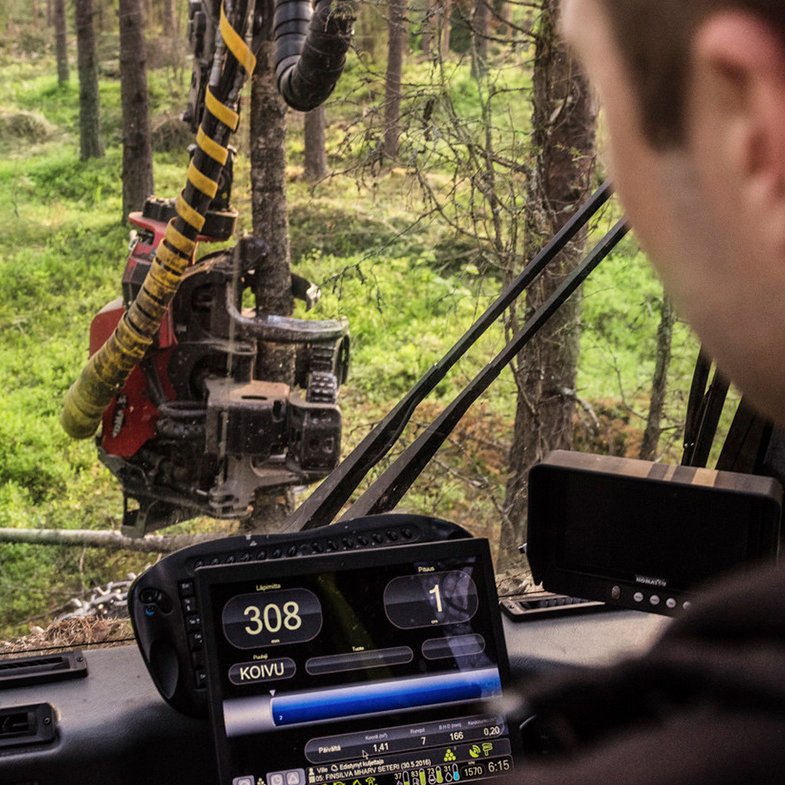
“With technology, we can direct wood supply work more precisely, and work phases and visits to the forest can be reduced. It always means savings, both in costs and for the environment,” says Hämäläinen.

It has been estimated that the forest industry could save over EUR 100 million per year in the coming years when it is possible to utilise all the data from forests. These savings make up almost ten per cent of the EUR 1.2 billion annual cost of harvesting and transporting trees. The potential benefits of the digital leap in our forests mean considerable cost savings.

Forest data to support decision-making

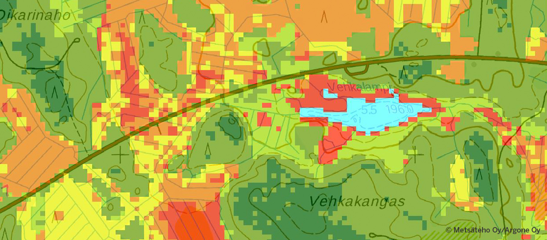
The forest asset data collected by the Finnish Forest Centre contain data on the soil, the amount of trees and their growth, forest management needs and felling possibilities. The data, which can be found in the metsaan.fi service, is now available to all Finnish forest owners, and in future it will also be made available to other forest industry users.

Forest owners will have all the information gathered from their forests. Furthermore, it is possible to give others permission to utilise the information. This way, a forest industry operator could approach a forest owner with a seedling stand management offer.

“Forest asset data is the foundation for all forest operations. It contains valuable information on stands that helps us to understand our forest reserves better. It makes the work of all forest industry operators easier,” says Olli Laitinen, Senior Vice President, Development, Metsä Group.

Thanks to digital forest asset data, a forest owner who lives elsewhere can use the online service to access high-quality information to help in decision-making, irrespective of where they are. “Forest asset data helps forest owners to understand their forest: what kinds of trees, habitat and nature value there are, and how the forest can be used – or left unused – either economically or recreationally. Nowadays, it is possible to calculate what kind of sales income can be made and what costs are incurred from forest management work. In addition, it is increasingly easy to visualise what the forest will look like after thinning or other forest management work,” Laitinen goes on to say.

Laser scanning
With laser scanning from aeroplanes, accurate 3D data on the structure of the trees and terrain in the forest can be obtained.
Information collection

Harvesters are important gatherers of forest data

There are around 2,000 harvesters working in Finland’s forests every day. They do not just fell trees; they also gather forest data and guide their operators in cutting trees.

In Finland, roundwood is usually cut to size already at the felling site according to the customer ordering the sawn timber. The harvester cuts the tree and measures the trunks according to the specifications.

Harvesters record a lot of information regarding the trees, which is mainly utilised as the basis for payments in wood trade and contracting, as well as in directing the procurement of wood. Data on felled amounts by wood grade is sent electronically to the buyer of the wood. The buyer knows at all times the amount and type of timber in roadside storage and where it is located. This information is crucial in the following work phase: the transportation of the wood.

Harvester
The harvester is also a data-gathering and data-utilising unit.

“Modern harvesters use GPS tracking and digital maps to define their precise location. Using the work instructions on the screen of the harvester, the operator can ensure that everything important has been taken into account in the forest and that job is done as agreed with the forest owner,” says Laitinen.

Towards precision forestry

The advantage of data from harvesters is that it is efficiently gathered during forest work. The long-term trend is that separate field trips are minimised and the necessary information is either gathered through remote sensing or automatically during operations.

“The significance of harvesters as gatherers of forest data is growing – they are taking us towards precision forestry. Working becomes more efficient and productivity increases when harvesters guide their operators. With better baseline data, the quality of work and planning improves when operators receive precise instructions on what to fell,” says Laitinen.

In the future, harvesters will be able to guide operators in planning logging tracks, i.e. the routes to be driven in the forest. Harvesters will also give instructions on how the shape and slope of the terrain and streams should be taken into account.

These kinds of pilot projects are already underway. In the future, forest automation will further ease the work of operators. Operators will be able to concentrate on critical decisions, i.e. what affects the environment and the upgrade value of the raw material, and what improves productivity,” says Laitinen.

The goal is to also use the data from the harvester to update forest asset data so that the data from the harvester is automatically submitted to the forest asset database.

Harvester

Augmented reality coming to harvesters

Advancing sensor technology and virtual reality are making harvesters even smarter. “Before long, laser scanners and cameras will automatically observe the surroundings of the harvester providing the operator with data on the number and type of trees in the area. The operator will utilise the data in making decisions, such as the selection of trees to be removed, cutting trunks to size and monitoring thinning intensity. In the future, it will be possible to project the instructions calculated from the measured data – the next tree to be removed, say – onto the windscreen of the machine over the actual view of the forest, so we can already talk about augmented reality,” says Jarmo Hämäläinen from Metsäteho.

AR
Harvesters can gather accurate 3D forest data using a laser scanner and make suggestions to the operator on what trees to fell.

“Metsäteho has tested different types of laser scanner with an eye to their use on harvesters, and the results have been promising. The technique automatically provides data on the number of trees as well as their diameter and sweep. Already, the fact that the operator gets real-time feedback on the quality of the work is enough to improve felling productivity and the thinning result,” Hämäläinen goes on to say.

Harvestability maps help to even out seasonal fluctuations in wood supply

The problem with wood supply in Finland is that there are a few too many sites that require the frozen ground of winter for harvesting, and too few sites that can be accessed when the ground has thawed. Harvestability maps even out seasonal fluctuations in harvesting and make the year-round harvesting of wood possible.

“Mills use wood steadily throughout the year, but we are not able to harvest wood steadily. A large part of trees are harvested in winter when the ground is frozen, and in summer harvesting capacity is under-used, when it is not possible to work in the forest. With the help of harvestability maps, thawed ground and winter harvesting sites can be identified and harvesting quantities balanced, and we can improve the year-round utilisation of machines. We have tested harvestability maps over two summers, and now we are getting them for production use,” says Olli Laitinen from Metsä Group.

Harvestability maps are forecasts of the ground’s load-bearing capacity based on permanent terrain conditions. The aim is that, in the future, harvestability map will be updated in real time so that data on changing conditions and load-bearing capacity at the time of harvesting can be taken into account. For example, the amount of snow the previous winter and the summer’s rainfall affect the actual load-bearing capacity of the ground when it is thawed.

Metsäteho map
A harvestability map sets out areas that can be harvested according to the season.
Wood truck

Optimised timber transport saves money and the environment

The forest and terrain data produced by harvesters also serves the next phase in the transport chain: forest transportation. Bases on the information received from the harvester, the driver of the forwarder knows where the woodpiles are and what kind of wood they contain. The forwarder also has access to information on the logging track network and terrain conditions. “The routes are planned so that all the wood is transported from the forest to roadside storage as efficiently as possible with minimum disruption to the environment,” says Laitinen.

Modern data systems are also an aid to planning long-distance transportation, as the instructions sent to the data systems of the timber trucks tell the driver which roadside storage area to go to, what timber to pick up, and when and where to deliver it. “Efficient control systems are in use in wood transport, and these are used to distribute the demand for wood between entrepreneurs and their vehicles so that production facilities have a steady stream of wood coming in,” says Laitinen.

Techniques are being developed for wood transport that would provide drivers with even better quality information on the drivability and passability of road networks. The aim is for hauliers to have advance information on the best route to drive to the wood storage area. “We have a good road network here in Finland, and even the small roads are marked on maps. On the other hand, we do not have information about the state of the roads, in particular for minor road networks that have a significant role in the transport of wood,” Laitinen goes on to say.

Logs

At the moment, we have a pilot project going on where mobile phones linked to vehicles film the road conditions and use machine vision to identify problem areas in the road, such as frost heaving or slippery surfaces. “The aim of these pilot projects is to develop systems that can be used to obtain road information in real time with data gathered by whoever drives along the road first. Up-to-date road information will benefit all the other road-users, too,” says Laitinen.


Read and learn more about our intelligent forests.

Virtual forests are here, and digitalisation is paving the way for intelligent wood products. Read more about how professionals in the field see the future of the forest industry.

Olli Laitinen

Olli Laitinen
Olli Laitinen is a forester and Senior Vice President of Development at Metsä Forest, part of the Finnish forest industry company Metsä Group. Laitinen has clocked up an impressive 33-year working history at Metsä Group. He came to the company to do his graduate thesis and never left! For the last few years, Laitinen has been working at Metsä Group’s headquarters in Espoo, where his responsibilities include the development of coordination in wood procurement.

Jarmo Hämäläinen

Jarmo Hämäläinen
Jarmo Hämäläinen is Research Director at Metsäteho, a company specialising in research and development. The main aim of Metsäteho’s operations is to study and develop the availability of wood, harvesting and transport technology as well as information management and operational efficiency. Hämäläinen has worked at Metsäteho since 1982 in different research and development positions. Lately, the scope of his work as research director has concentrated on the digitalisation of wood supply.